/
Cyclonic Storm Murasu intensifies, severe storm likely before Andhra landfall Nov 2-3
Cyclonic Storm Murasu intensified over the Bay of Bengal on Sunday and is forecast to strengthen further before landfall on the south Andhra Pradesh coast late Nov 2 or early Nov 3. Winds at landfall may reach 100–110 km/h with gusts to 120 km/h, with heavy rain and squalls expected along parts o...
R
4 min
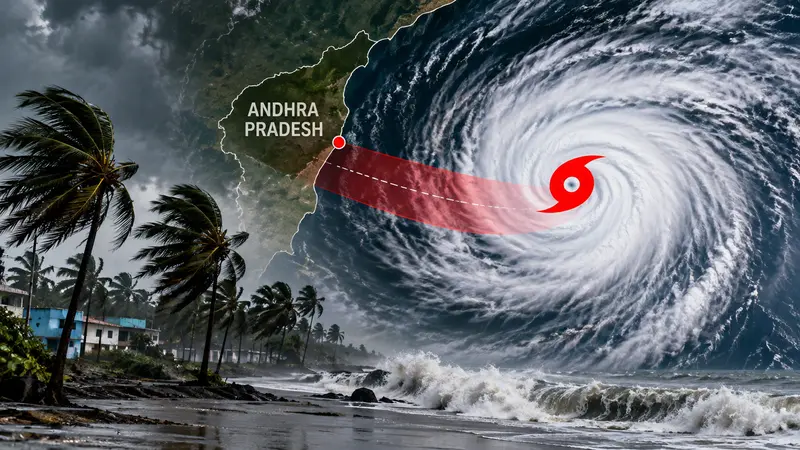
Cyclonic Storm Murasu strengthened over the Bay of Bengal on Sunday, with forecasters warning it is likely to intensify further before crossing the south Andhra Pradesh coast late on November 2 or early November 3.
At 2:30 p.m. IST, the India Meteorological Department (IMD) said the storm was centred about 630 km east-southeast of Nellore. It was moving west-northwest at around 23 km/h, with sustained winds of 65–75 km/h and gusts up to 85 km/h.
A separate weather bulletin issued at noon placed the system near latitude 12°N and longitude 85.2°E over the southwest and adjoining west-central Bay of Bengal. That bulletin said maximum sustained winds were about 62 km/h near the centre, rising to 88 km/h in stronger bursts.
Forecasts through Sunday evening pointed to a further strengthening into a severe cyclonic storm before landfall. The projected landfall zone remains between Nellore and Narsapur, a stretch of coast that includes low-lying settlements and river mouths that can flood quickly when storm surge coincides with high tide.
Landfall window and wind threat
The IMD’s forecast track puts the core of the system approaching the south Andhra Pradesh coast late Monday night and into Tuesday morning. During landfall, winds are expected to reach 100–110 km/h with gusts up to 120 km/h near the centre.
Those wind speeds are high enough to bring down weak trees, damage temporary structures and disrupt power and communications, particularly in coastal blocks where overhead lines run close to vegetation. Seas are expected to remain rough near the storm centre, prompting warnings for shipping and small craft.
Ports in the region have been asked to raise warning signals as conditions deteriorate offshore. Authorities have also issued advisories to keep vessels away from the storm’s path and to secure anchored craft.
Fishermen have been told to suspend operations, with a clear warning not to venture into the Bay of Bengal through November 4. The message is aimed at preventing boats from being caught in squally winds and high waves that can build rapidly as the cyclone strengthens.
Along the northern coastal belt of Tamil Nadu and Puducherry, squally weather is expected, with gusty winds forecast in the 40–75 km/h range. While the storm’s centre is projected to cross farther north, outer rainbands and shifting winds can still affect coastal stretches well away from the landfall point.
In Odisha, southern districts are bracing for widespread rain and squally winds beginning November 2. Reports indicated rainfall totals of 7–20 cm were possible in some areas as the system’s moisture feeds into bands that sweep up the coast.

Kolkata, too, is likely to see light to moderate rain or thundershowers over the next three days as Murasu intensifies over the Bay of Bengal. While the city is not on the expected landfall line, the cyclone’s circulation can still draw moisture inland and trigger intermittent showers.
Weather officials cautioned that track and intensity forecasts can change as the storm interacts with surrounding winds and sea-surface conditions. Residents in coastal districts were urged to follow updated bulletins through Monday and Tuesday.
Preparations on the coast
Andhra Pradesh has been placed on heavy alert along coastal zones, with disaster response teams deployed on standby. Reports said National Disaster Response Force units and local response personnel have been readied for evacuation support and rescue work if flooding or structural damage occurs.
In parts of southern Odisha, administrations have begun proactive evacuations in high-risk pockets, focusing on areas prone to waterlogging, river overflow and coastal inundation. Officials have also moved to prepare cyclone shelters and keep essential supplies available, according to reports.
Across the threatened coast, the immediate priorities are familiar: clearing drains, securing hoardings, pruning weak branches near power lines and identifying communities that may need to move before winds rise. The landfall window, late November 2 into early November 3, leaves limited time for last-mile action.
For residents, the practical advice is straightforward. Stay off beaches and sea walls as swells build. Charge phones and keep torches ready in case of outages. If told to move, go early, not when winds are already up.
The next round of official bulletins is expected to refine the storm’s path and the distribution of damaging winds and heavy rain as Murasu closes in on the Andhra Pradesh coast.
R
4 min
What did you think?